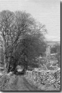
Review of ‘Tideswell Tracks’, by Eric HeafThis review was published originally in The Peak Advertiser, the Peak District's local free newspaper, on 20th December 1999. Please note this volume is now sadly out of print.
Also, this pamphlet contains interesting notes on the different types of medieval travellers and how they chose the routes over the characteristic topography of the White Peak. The Romano-British settlement in Monksdale is re-surveyed because it was crossed by an ancient packhorse way. This work will appeal to anyone who is interested in the limestone landscape and the way travellers have crossed it during centuries past. There are seven purpose drawn maps and many Grid References. With the 2½ inch (1:25,000) Ordnance Map of the White Peak Area this will make fascinating armchair study during the winter months. |
|||
